When man migrated from Africa they travelled mainly along the coast where a lot of bounty could be found that sustained their travels. Besides the obvious fish and shellfish, a little further inland many plants and animals where gathered and hunted to set those earliest of globalists on a steady pace conquering all corners of the globe. Still the majority of mankind is located along the coasts of the continents.
Rivers where the obvious next step to trek further inland and discover the wealth these new territories had to offer. And what they found was nothing short of amazing. Abundant fresh water in lakes and streams, teeming with fish, new plants and animal species to thrive on. Minerals of all sorts, different ores of metal and new types of timber ready for imaginative minds to explore their possibilities. After the stone age, first copper and then iron working, construction of villages into cities and the “major” invention that boosted humans into the modern world: agriculture. Riverbeds flat enough formed the perfect base for crops to grow and sustain life on an ever more growing scale.
Planning our route through Europa never intended cycling along as many rivers as we did. Why did we? Visiting my Mom and her friend on the Moezel river made us plan our route down Germany along this river system. We wanted to cycle without any big hills to climb and just ease into long distance cycling. Being Dutch, where almost the whole country is flat, and now loaded with quite some gear on our bikes, some of us found the first mountain of the Netherlands (they call the highest point a mountain but of course it is a reasonable hill of 323m above sea level) to bite the muscles a bit. Google maps made it easy to drag the route to our desired elevation profile and off we went.
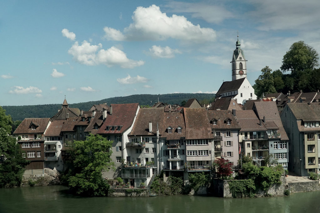
It was cycling at it’s best so far. Climbing a couple of meters every ten kilometers, we never even felt that we where gaining height. Lots of nice bigger and smaller towns, perfect for groceries and water. The mountains sides just jam packed with grape vines, the most important export commodity of the Moezel region. The slopes and the way they retain heat are optimal to produce world famous wines. This is also one of the most early populated regions of Germany with the oldest village Neumagen-Dhron, where we stayed on maybe the oldest camping, and also the oldest city Trier. At the city of Konz al little further, we exchanged the Moselle for it’s tributary the Saar river. Not far from here the Moselle defines the border between Germany and Luxembourg.
Riding up the Saar gave a new dimension to the river riding experience. The valley is narrow at it’s mouth and opened up the higher we climbed. Some spectaculair mountain trails led us into one of the most beautiful villages ‘Saarburg’. Here we could still see how the water from the mountains was used for early industrial uses. The surrounding natural area is peaceful, clean and respectfully used by the inhabitants: a joy to ride along. Further up things changed and we where in for a shock. At Völklingen the other side of the river gave rise to a massive steel foundry. An eerie place with a retro futuristic look, something out of an old space movie. It continued for several kilometers, just huge and intimidating. As we found out this is a UNESCO world heritage site, a steel smelting plant build in 1873, one of it’s kind still intact. Now it is being preserved for mankind and used for cultural purposes. (You can see a bit of it in our youtube video here!)
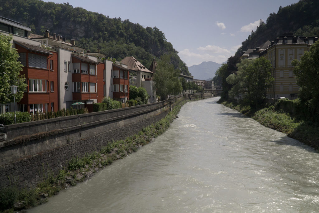
The mighty Rhine, one of the major rivers of Europe, where the Moselle and so also the Saar flow into, defines the border between France and Germany between the twin mountain ranges of the Vosges and the Black Forest. It flows windingly and would take to many kilometers to meet our appointment with a dear friend in Switzerland. The route plotting software suggested a network of French canals making shipping in this area possible. Coming down from the Lower Vosges range at Lutzelbourg, the almost endless sequence of sluice steps of the ‘de la Marne au Rhine’, to get in and out of the mountains, made a way for us down to Strasbourg. Ideal riding turned into a bit of a bore along the ‘Rhone au Rhine Nord’ canal that runs along the Rhine south to the three land point with Switzerland an Germany. Long and nothing really to quench the thirst of the eyes, except great vistas of the mountains that where sometimes visible. What really was interesting though: a local told us how once the Vosges and the Black Forest where one mountain range. The Rhine flowed underground at that time eroding the central part of the range. After the mountains sunk away the Rhine valley remained, wide and fertile. Now that would make for a great time-lapse!
Once in Switzerland we got the first glimpse of the highest mountain range in central Europe: the Alps. Here is where a lot of water feeding the diverse rivers of Europe comes from. Riding through the maze of peaks and valleys brought us a beautiful climb through the Austrian Klostertall valley up to the St. Christoper pass at 1800m. The somewhat sizeable river at Feldkirch near the Austrian-Liechtenstein border turned into a little trickle at the pass, the end of our journey up the Rhine system. At the other side drops that turn into torrents run down to form the Danube river that flows through 10 countries in Europe and empties in the Black sea. Also the culture changed with the water. Before the pass people feel more Swiss than Austrian and once in Tirol over the pass the stereotypical St. Ankton am Tirol defined the Austrian image burned into our Dutch eyes by the television at home.
Rivers will be a sanctuary for us when the riding gets tough and we need a little break or need to take it easy. For instance in Italy where the sun was burning us from our bikes from 11 until 6. We had to cross the north Italian “flats” from the Appenine mountains to meet meet family and friend near the Dolomites. The first time over from the Alps to our Workaway address was in a hurry so the more main routes in the flats where pretty boring and hot. With the sourcing heat as our enemy, water nearby to cool and relax made a huge difference. Also we learned to plot our routes a little bit better and without time pressure we rode and enjoyed the backroads and waters of northern Italy. Also sorbetti, which is frozen water in all kinds of delicious flavours, was a big motivation to keep on going ;.)
Pro’s
- Nearly flat cycling, just a little bit up or down
- Navigation is very easy
- Highways of civilisation with all the facilities you will ever need
- Historical sites to explore
- Always water to wash, clean, and after purification to drink
- A welcome escape from the heat of summer, find or make some shade nearby
Con’s
- Can be too crowed for your taste
- At moments monotonous riding along agricultural landscapes
- Winding curves take longer to reach a destination
- For a challenging ride this is often not the way to go